
 PORTUGUÊS
 ESPAÑOL
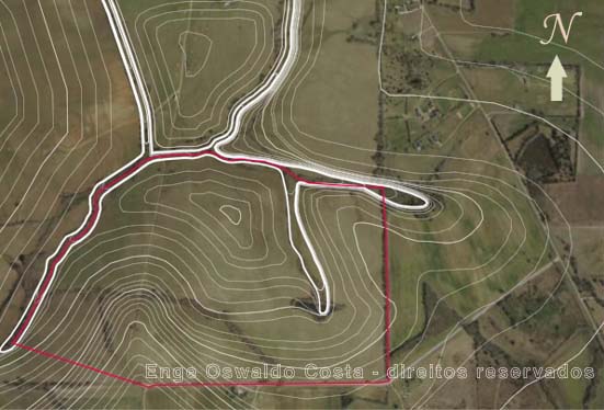
The preliminary studies define how the analyzed pieces of land shall be developed, how to deal with the terrain itself and, finally, how the project shall deal with possible environmental questions that may arise. It is an important part of the project to assure that the final result is compliant with current laws and urbanistic constraints.
Such preliminary studies bring digital image composition as well. These images provide viewing the previously executed planialtimetric survey overlapping an aerophotogrammetric image.